Beschreibung
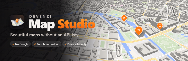
Embedding Google Maps usually means an iframe you cannot style, no places of your own, an API key with a credit card and, on top of that, a cookie banner. Map Studio works differently. It gives you modern vector maps based on OpenStreetMap, and you design them in a full-screen editor made for maps instead of filling in forms.
Use it as a Google Maps alternative for your contact page, a store locator for your branches, a location map with your own pins and markers, or an interactive map with areas and routes.
Highlights
- 3D buildings that rise when you tilt the map, all the way to the horizon.
- Light and sky: day, morning, evening, night, or live with the sun as it stands right now at your place.
- Routes along real roads and paths by car, bike or on foot, with stops you drag. They work without a key (OpenStreetMap routing of FOSSGIS); if you prefer, use openrouteservice, GraphHopper or your own OSRM or Valhalla server.
- Your brand colour for the whole map, pins, areas and buttons.
- A store finder: a list of places with search, category filter, „Near me“ and „open now“. You can import your locations from Excel.
- A full-screen studio: click a place on the map and change it right there, with 66 icons, photos, popups that open on click, on hover or always.
- No API key, no account, and if the map loads only after a click, no cookie banner either.
Nothing to sign up for
Install it, open Map Studio and start designing. You need no sign-up, key or billing account. The maps are sharp on every screen and zoom smoothly. Even routes along real roads work without a key; you only enter one if you prefer openrouteservice or GraphHopper for them.
Designing, not filling in forms
- The map fills the screen; your places on the left, the look on the right, the tools at the bottom.
- Menus instead of long settings pages: every choice is shown as it will look (real pins, real map styles, little scenes of your map), in clear sections you can put in your own order.
- Search an address, street, town or business with suggestions while you type. Or click a station, shop or café of the map itself and add it as a place, with a fitting icon and its kind as category.
- Every panel is one page you scroll through; put its topics in your own order and drag the panels to the size you like.
- Undo and redo, keyboard shortcuts, and a preview as visitors see it on computer, tablet and phone.
- Start empty or with a template: store finder, delivery area, hiking route, event site plan.
- Import places and shapes from a table (CSV/Excel; addresses are found automatically), Google My Maps (KML) or GeoJSON.
Your brand colour
Six map styles as preview tiles: light, night, colourful, clear, fjord and „Brand colour“, which recolours the whole map from one colour. Pins, areas and buttons follow along. Colours you pick yourself are kept for your next maps.
Light and sky: day, morning, evening, night, or „Live“ with the sun as it stands right now at this place.
Your own places
- 66 icons in groups with a search, or a photo; as drop, circle, square or just the icon, in three sizes or any size, for the whole map or per place; any colour per place.
- Popups with the place’s icon, formatted text, several photos to swipe through, a button to your page and „Get directions“. They open on click, on hover or are always open, in the width you drag them to.
- The map’s own stations, shops and cafés show what they are when clicked.
- Opening hours with „Open · until 18:00“ right in the popup and the list.
- Categories as tags; highlight important places with a bigger pin, and keep them out of group bubbles.
- List of places next to or below the map, with category filter, search and „Near me“: sorted by distance from the visitor’s location, or from a postcode or town they type in.
- Many places? Nearby pins group into a bubble with their number.
Areas and routes
- Draw a delivery zone, a district or a walking route right on the map, and edit its points later.
- Or plan a route along real roads and paths by car, bike or on foot, with stops you can drag. No key is needed (OpenStreetMap routing of FOSSGIS), but you can use openrouteservice, GraphHopper or your own server if you prefer.
- Like in a navigation app, you pick one of several ways, and the route keeps its directions („Turn left onto …“) for your visitors.
- Areas show their size and can have their name in the middle; routes show their length, start and finish.
- Fill and outline colour, opacity, line width, solid, dashed or dotted lines.
3D and more
3D buildings far into the distance, a compass to turn the map, fullscreen and „my location“ buttons, a night style for visitors in dark mode, and the map can be kept to one area.
Privacy-friendly (GDPR)
- Optionally the map loads only after a click („load after click“), with your own notice text.
- Nothing is loaded before the map scrolls into view.
- A privacy page in the admin shows what is loaded when, plus a ready-made text for your privacy policy.
Saved maps and shortcode
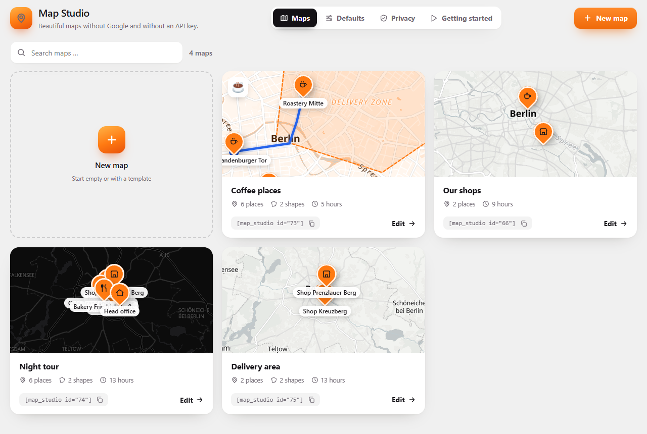
Make a map once and use it anywhere: with the „Map Studio“ block, the „Map Studio“ map widget in Elementor (also with the free Elementor), or with [devenzi_map id="…"] in Divi, widgets and classic themes. Change it once, and it changes everywhere. All maps at a glance as live maps, and defaults for new maps with a live preview.
Switching is easy
Coming from WP Go Maps, WP Maps or WP Store Locator? Map Studio finds your maps and brings them over with one click: places, categories, areas, lines and circles, and for stores their address, phone and opening hours. Your pages need no changes. Once you deactivate the old plugin, its shortcodes and blocks show the maps brought over. Honest comparisons, including where the other plugin is the better choice: WP Go Maps, WP Maps and WP Store Locator.
Fast
The map library is only loaded on pages with a map, and only when the map comes into view.
Map Studio Pro
For maps that tell a story. Pro adds:
- Story maps: while visitors scroll, the map flies from place to place and routes draw themselves.
- Ride along and presentations: the camera flies along a route, with stops that show text, a photo and a view of their own.
- GPX with elevation profile for hikes, bike rides and runs.
- „How do I get there?“: visitors plan their way to a place right on your map.
- Relief with shaded hills and real 3D mountains when you tilt the map.
- Satellite and hybrid styles, Street View in the popup, and opening hours, phone and website of the map’s own places.
- Your own map data: the map of your region on your own server, so nothing is loaded from other servers.
Everything in the free version stays free and complete.
Languages
English. Translations, German among them, come through translate.wordpress.org.
External services
Map Studio relies on the third-party services below. Each one is listed with what it is used for, what is sent and when, and its terms and privacy policy. None of them needs an account unless noted. Nothing else is sent anywhere, and the plugin has no tracking. The plugin’s own scripts and styles and the map library (MapLibre) are included in the plugin.
OpenFreeMap: the map
- What it is for: the map itself (map tiles, fonts and icons). Needed on every page with a map and in the editor.
- What is sent and when: the visitor’s IP address and which part of the map is shown, by the visitor’s browser, when a map comes into view. With „Load maps only after a click“ (Map Studio Privacy), only after the visitor clicked „Load map“.
- Server: tiles.openfreemap.org
- Provider: OpenFreeMap (Hyperknot Software Kft., Hungary), delivered through Cloudflare · https://openfreemap.org/
- Terms of service: https://openfreemap.org/tos/ · Privacy policy: https://openfreemap.org/privacy/
Photon by komoot: address search
- What it is for: the search for addresses and places in the editor (Map Studio), name ideas (the address) for a new place, and the postcode or town visitors can type next to „Near me“ in the list of places.
- What is sent and when: in the editor, the words typed into the search, or the coordinates of a new place, by the browser of the person editing the map, only while they search or set a place. For „Near me“, what a visitor typed, asked by your website (not by the visitor’s browser) only when the visitor searches; the result is kept for a week. Visitors of the site never connect to Photon, and their IP address is not passed on. Switch it off per map with „Visitors can also type a place“.
- Server: photon.komoot.io (paths /api and /reverse). With Pro and your own route server, „How do I get there?“ also searches the start address here, asked by your website, not by the visitor’s browser.
- Provider: komoot GmbH, Germany · https://photon.komoot.io/
- Terms of service: https://www.komoot.com/terms-of-service · Privacy policy: https://www.komoot.com/privacy
Route planning: one service, the one you choose
A route along real roads and paths in the editor („Connect“, „Plan a route“, drawing along the ways). Your website’s server asks the service chosen under Map Studio Settings Route planning, only while you plan a route. The route is then saved with the map, and visitors never connect to the service. Sent: the coordinates of the route’s stops and the way of travelling (on foot, by bike, by car), with your key if the service needs one, and your website’s address as user agent, never anything about visitors. Maps name the route service next to their routes only if you switch on „Name the route service on the map“ there.
OpenStreetMap routing of FOSSGIS (the default, no key)
* What it is for: routes in the editor, at most one request a second; never for visitors.
* Server: routing.openstreetmap.de (path /routed-foot, /routed-bike or /routed-car)
* Provider: FOSSGIS e.V., Germany · https://routing.openstreetmap.de/
* Terms of service: https://www.fossgis.de/arbeitsgruppen/osm-server/nutzungsbedingungen/ · Privacy policy: https://routing.openstreetmap.de/about.html (section „Privacy“)
openrouteservice (needs your own free key)
* What it is for: routes in the editor.
* Server: api.openrouteservice.org (path /v2/directions; with Pro also /geocode/autocomplete, the address search of „How do I get there?“)
* Provider: HeiGIT gGmbH, Heidelberg, Germany · https://openrouteservice.org/
* Terms of service: https://account.heigit.org/info/tos · Privacy policy: https://heigit.org/privacy-policy
GraphHopper (needs your own key)
* What it is for: routes in the editor.
* Server: graphhopper.com (path /api/1/route; with Pro also /api/1/geocode, the address search of „How do I get there?“)
* Provider: GraphHopper GmbH, Munich, Germany · https://www.graphhopper.com/
* Terms of service: https://www.graphhopper.com/terms/ · Privacy policy: https://www.graphhopper.com/privacy/
Your own OSRM or Valhalla server: only the address you enter; nothing goes to a third party.
„Get directions“: a link, if you switch it on
- What it is for: a button in a place’s popup that opens the way there in Google Maps, Apple Maps or OpenStreetMap (as you choose).
- What is sent and when: nothing until a visitor clicks it; then the visitor’s browser opens that site with the coordinates of the place.
- Google: terms https://policies.google.com/terms · privacy https://policies.google.com/privacy; Apple: terms https://www.apple.com/legal/internet-services/maps/terms-en.html · privacy https://www.apple.com/legal/privacy/; OpenStreetMap: terms https://osmfoundation.org/wiki/Terms_of_Use · privacy https://osmfoundation.org/wiki/Privacy_Policy
Only in Map Studio Pro
Map Studio Pro is not part of this plugin: it is a separate download from https://devenzi.com/map-studio.html, sold and delivered there by our reseller Freemius. This plugin does not connect to Freemius; its „Get Pro“ and „Try Pro for free“ buttons are plain links. Pro’s services, for completeness:
- Terrain Tiles on Amazon Web Services (AWS Open Data, data by Mapzen/Tilezen, https://registry.opendata.aws/terrain-tiles/): elevation for the Relief style, loaded by the visitor’s browser only on maps in that style. AWS terms: https://aws.amazon.com/service-terms/ · Privacy: https://aws.amazon.com/privacy/
- Google Street View (Maps Embed API, with your own Google key) and Mapillary (https://www.mapillary.com/) for Street View in popups and the Street View figure, loaded by the visitor’s browser only when a visitor opens Street View. Google terms: https://cloud.google.com/maps-platform/terms · Privacy: https://policies.google.com/privacy · Mapillary terms: https://www.mapillary.com/terms · Privacy: https://www.mapillary.com/privacy
- Details of the base map’s places from Nominatim (https://nominatim.openstreetmap.org/) and the lines at a stop from Overpass (servers: overpass-api.de or overpass.private.coffee; or your own server), asked by your website and kept for a week. Nominatim usage policy: https://operations.osmfoundation.org/policies/nominatim/ · Privacy: https://osmfoundation.org/wiki/Privacy_Policy · Overpass: https://wiki.openstreetmap.org/wiki/Overpass_API
- „How do I get there?“: visitors plan their way to a place. Their browser asks only your website; your website asks the route service you chose (openrouteservice, GraphHopper or your own server, but not the routers of FOSSGIS) with the visitor’s start, and for the address search openrouteservice, GraphHopper or, with your own server, Photon (komoot GmbH, https://photon.komoot.io/). The services never see the visitor’s IP address.
- Photos for a place from Wikimedia Commons (https://commons.wikimedia.org/, only freely licensed photos, with credit) and Mapillary; a photo you take is copied into your media library. Wikimedia terms: https://foundation.wikimedia.org/wiki/Policy:Terms_of_Use · Privacy: https://foundation.wikimedia.org/wiki/Policy:Privacy_policy
Map data © OpenStreetMap contributors (https://www.openstreetmap.org/copyright).
The pictures on the Map Studio start page (assets/img/hero) are maps made with the plugin: map data © OpenStreetMap contributors, OpenMapTiles, OpenFreeMap; elevation for the Alps from the Terrain Tiles (Mapzen); the aerial picture of Cologne: Land NRW (2026), Datenlizenz Deutschland – Zero – Version 2.0 (https://www.govdata.de/dl-de/zero-2-0).
Source code
The plugin bundles MapLibre GL JS 6.14.0 (BSD-3-Clause) in assets/vendor/maplibre, with its license file. Its source is at https://github.com/maplibre/maplibre-gl-js. For the „Modern“ style it bundles the font Inter (SIL Open Font License 1.1, https://github.com/rsms/inter) in assets/fonts, with its license file. The plugin’s own JavaScript and CSS are not minified and need no build step.
Screenshots




Blöcke
Dieses Plugin bietet 1 Block.
- Map Studio A beautiful map with your own places – without Google and without an API key.
Installation
- Install Map Studio under Plugins Add New and activate it.
- Go to Map Studio New map. The full-screen editor opens.
- Pick a style, search or click to add places, save.
- In a post or page, add the „Map Studio“ block and choose your map, or paste its shortcode into a page builder or widget.
FAQ
-
Do I need an API key or an account?
-
No. The map tiles come from OpenFreeMap, a free and open map service, and routes along real roads are planned with the free OpenStreetMap routers of FOSSGIS. There is nothing to sign up for. Optionally, you can choose openrouteservice or GraphHopper with your own key, or your own OSRM or Valhalla server, under Map Studio Settings.
-
Is it really free? Are there limits?
-
The plugin is free. OpenFreeMap has no usage limits for normal websites. If you want to be completely independent, Map Studio Pro hosts the map data for your region on your own server and adds GPX routes with an elevation profile and story maps.
-
Is it GDPR-friendly (DSGVO)?
-
When a map is shown, the visitor’s browser loads the map tiles from OpenFreeMap (IP address is transmitted). If you have no consent tool, switch on „Load maps only after a click“ under Map Studio Privacy: then nothing is loaded until the visitor agrees. The privacy page also gives you a text for your privacy policy. This is not legal advice. More in our guide Google Maps and the GDPR in WordPress.
-
Once a visitor clicks „Load map“, their browser remembers it (local storage, no cookie) and the other maps on your site load directly. With Pro, a map with relief or aerial images asks once more, for those servers. Map Studio also asks these cookie tools through their documented JavaScript interfaces:
- Complianz: consent to the category „marketing“.
- Borlabs Cookie 3: consent to a service with the ID
map-studio(create it, e.g. with OpenFreeMap as provider). - Real Cookie Banner: consent to a service with the unique name
map-studio.
Other categories or service names: the filter
devenzi_map_consent_tools(keyscomplianz,borlabs,rcb; empty switches one off). Any other tool: callwindow.devenziMapConsent()in its opt-in code on every page view (or setwindow.devenziMapConsentGiven = truebefore the map script runs). To let visitors take it back as easily as they gave it, put the shortcode[devenzi_map_consent]on your privacy page: it shows a button „Withdraw my consent for maps“ (the suggested privacy text already contains it). In your own code,window.devenziMapConsent( false )does the same. When a visitor agrees with the button, the page fires the eventdevenzi-map-consentondocument. -
Can I use it with Elementor, Divi or classic themes?
-
Yes. In Elementor, add the „Map Studio“ widget and choose your map. It shows live in the editor, with a button to the Map Studio. Everywhere else, paste the shortcode
[devenzi_map id="…"]where shortcodes work (Divi, widgets, classic themes). You can also change the height:[devenzi_map id="12" height="400"]. -
Can I show many locations, like a store locator?
-
Yes. Import your locations from a table or add them one by one, then switch on the list of places. Visitors can filter by category, search, sort by distance with „Near me“ (from their location or a postcode they type), and see who is open right now. The „Store finder“ template sets all of this up. See also Store locator for WordPress.
-
Does it replace Google Maps?
-
For showing your locations, areas and routes: yes. „Get directions“ still hands over to Google Maps, Apple Maps or OpenStreetMap, but only when a visitor clicks it. Our guide Google Maps alternative for your website compares the options.
-
Is it an alternative to Mapbox?
-
For vector maps, yes. Map Studio uses MapLibre GL JS, the open-source library that grew out of Mapbox GL JS, with tiles from OpenFreeMap. You need no account and no access token.
-
Can I switch from WP Go Maps, WP Maps or WP Store Locator?
-
Yes, and your pages need no changes. When Map Studio finds maps from WP Go Maps or WP Maps, Map Studio Maps shows them with their markers, categories, areas, lines and circles; tick the ones you want and bring them over. The stores of WP Store Locator become one store finder map with address, phone, opening hours and categories, the list beside the map and „Near me“. Then deactivate the old plugin: its shortcodes and blocks on your pages now show the maps brought over. Activate it again and everything is as before. Google styles, your own pin images, heatmaps, image overlays and routes from Google’s directions do not come over; Map Studio lists what stays behind for each map. Step by step and side by side: WP Go Maps, WP Maps and WP Store Locator.
-
The map stays grey with WP Rocket, LiteSpeed Cache or another speed plugin
-
Options like „Delay JavaScript execution“ (WP Rocket), „Load JS Delayed“ (LiteSpeed Cache) or „Delay JavaScript“ (Perfmatters) start scripts only after the visitor’s first click or scroll, so the map waits until then. Add these two words to the plugin’s list of exclusions:
devenzi-map(the map’s scripts) anddevenziMapData(its settings on the page). Nothing is lost by it: the map library itself is still loaded only when a map comes into view. Combining or minifying JavaScript is fine. -
The map says „The map could not load.“
-
The visitor’s browser could not reach the map. Most often a blocker or a strict firewall keeps it from tiles.openfreemap.org, or the site sends a Content Security Policy without it. In that case, allow https://tiles.openfreemap.org there. „Try again“ asks once more. With Map Studio Pro and your own map data, nothing has to come from other servers.
-
What happens when I delete the plugin?
-
By default, your saved maps and settings stay, so you can switch to Pro or reinstall without losing anything. To remove everything when you delete the plugin, switch on „Remove all maps and settings“ under Map Studio Settings first. Maps placed directly in posts always stay in the post content but are no longer shown without the plugin. Photos you added to a place stay in your media library either way.
Rezensionen
Zu diesem Plugin liegen noch keine Rezensionen vor.
Mitwirkende und Entwickler
„Devenzi Map Studio – OpenStreetMap, 3D Maps, Store Locator & Routes“ ist Open-Source-Software. Folgende Menschen haben an diesem Plugin mitgewirkt:
Mitwirkende
Übersetze „Devenzi Map Studio – OpenStreetMap, 3D Maps, Store Locator & Routes“ in deine Sprache.
Interessiert an der Entwicklung?
Durchstöbere den Code, sieh dir das SVN-Repository an oder abonniere das Entwicklungsprotokoll per RSS.
Änderungsprotokoll
0.5.3
This release is about not losing work.
* Two windows on the same map no longer overwrite each other. When the map was saved elsewhere in the meantime, the studio asks whether to load the newer version or keep yours.
* A map deleted in another window is not brought back by the studio’s autosave; the studio asks.
* „Recently deleted“ below your maps: deleted maps can be restored from there until WordPress empties the trash. Undo after deleting now restores the map with its address.
* Import: tables with more than 500 places say so before importing, and the message afterwards names why rows were left out. Leaving the page while addresses are still being looked up asks first.
* Import: GeoJSON with multi parts comes in completely, round trips stay closed, long routes keep their last point, KML with spaces in coordinates reads correctly, and KMZ, UTF-16 tables and quote marks inside cells are handled.
* Bringing maps over from WP Go Maps, WP Maps or WP Store Locator again no longer replaces the changes you made here unless you tick „Replace my changes“. Two runs at once and maps without a usable position are handled and named in the report.
* Authors and multisite users: „&“, „<“ and quotes in names stay as typed.
* „Duplicate“ also works for published maps of colleagues; „Ask before deleting“ can be switched off again.
* Saved maps are read over the REST API only by people who can make maps.
* Deleting the plugin with „Remove all maps and settings“ switched on now also removes your personal studio preferences and the notes of imports.
* Pro: GPX files bring every track part, route and waypoint; elevation profiles no longer start at 0 m.
* Pro: photos the studio copied into the media library are only cleaned up when nothing on the site uses them any more – also not in page builders, shop galleries or custom fields – and only after a day.
* Pro: deleting a region while it downloads works reliably, and maps fall back to OpenFreeMap when a region’s file is missing.
* Pro: place details and visitor directions are shared fairly – one visitor can no longer use up the day’s limit for everyone.
0.5.2
- A new map style, „Modern“: white streets, slate grey main roads, fresh green and clear water, with the font Inter. New sites start with it; sites that already have maps keep their default.
- Times of day in the Modern style have colours of their own instead of a filter over the map, so names and roads stay sharp at night.
- Routes run behind 3D buildings; the part a building hides is dotted.
- Pick your way: after planning a route between two stops, the studio shows the other ways in grey with their length and time. Click one to take it. With openrouteservice, GraphHopper or Valhalla there is also a way without motorways.
- Directions: a planned route keeps its turn by turn directions. Visitors open them in the route’s popup and click a step to see it on the map. You can switch them off per route.
- Pro: the big turns of the directions become notes of the presentation with one click, and the ride shows the current step.
- Pro: stations also list the buses and trams that stop right next to them, one row per kind.
- Pro: your own places show the photo, lines and opening hours of the OpenStreetMap place they stand on.
- Pro: photos from Wikimedia Commons show again in the popups of the map’s places.
0.5.1
- Maps load faster: names that the map styles set in italic (water, places of interest) now use the regular font, so a page with a map downloads one font file less, about 45 KB.
0.5.0
- „Near me“ with a typed place: next to the button, visitors can type a postcode or town and the list is sorted by distance from there. Handy on computers without GPS. Your website looks it up, so the visitor’s IP address stays with you.
- Buttons of places can be marked as an affiliate or sponsored link (rel=“sponsored“).
- „Put on a new page“: one click in the studio or the overview creates a draft page with the map and opens it.
- A heading and a short text for the map, inside its frame, so they look like part of it on any page, also with the shortcode, Elementor or Divi.
- Places have an address: taken from the search or looked up at the pin, shown in the popup and the list. Imports from tables, WP Go Maps, WP Maps and WP Store Locator fill it.
- New maps name themselves after their place or town („Map of Cologne“) until you give them your own name.
- New maps open around your last map, or in the country of your site, instead of over all of Europe. Returning users find the templates at the top of the overview.
0.4.0
- Bring your maps over from WP Go Maps, WP Maps and WP Store Locator: Map Studio Maps lists them with what is on them; tick and bring them over with places, categories, areas, lines and circles. The stores of WP Store Locator become one store finder with address, phone, e-mail and opening hours.
- Your pages keep working: once the old plugin is deactivated, its shortcodes and blocks show the maps brought over. Activate it again to switch back.
- New maps start with the „Colourful“ style. Sites that already have maps keep „Light“ as their default.
0.3.1
- Popups on narrow maps and phones are no longer cut off at the edge of the map.
- The search field of the list keeps its own size instead of taking the theme’s text size.
- KML import: every line and area of a multi-part placemark (Google Earth, track exports) comes along, not only the first.
- The editor in narrow windows: the top bar no longer runs under the right panel.
- A shape left while it was still being drawn no longer stays behind empty.
0.3.0
- The Relief style (shaded hills, 3D mountains) is now part of Map Studio Pro; this plugin loads no elevation data.
- Draw a route by hand along the ways (straight, on foot, by bike or by car) and change its kind later.
- Quick buttons in the list of places and shapes; a click flies there and opens the popup.
- New places show at once; the editor stays smooth with many places.
- Translations come from translate.wordpress.org.
0.2.0
- Plan routes along real roads and paths with openrouteservice (your own free key), with stops you can drag and insert.
- Stations, shops and cafés of the base map show a popup and can be added as a place, with a fitting icon and their kind as category.
- Popups with the place’s icon and small icon buttons; per place: open on click, on hover or always; width dragged at the edge.
- Per place: its own pin shape and size (also any size), „never group“; 66 icons with groups and search; your own colours are kept.
- Several places at once (Shift + drag a frame, Shift or Ctrl + click, Ctrl+A): move, colour and remove them together, or connect them with a route (straight or along streets) that follows when a place moves.
- Symbols of the map: choose which places of the base map show, by group (food, shops, bus and train, parking, fuel, playgrounds, nature …) and finer by kind.
- Name ideas for a new place: its address with house number, the two streets of a crossing, or a business right there. One click takes the name.
- Pro: „Getting there“ in a place’s popup shows the stops around it (underground, city train, tram, bus, ferry) with their lines and minutes on foot within 5 to 20 minutes, and its part of town.
- Pro: one click, and the place is finished. It names itself after the business or station right there, takes its icon, and finds up to four photos (Wikimedia Commons, Mapillary) that are copied into the media library with their credit; more to pick under Photos.
- Controls in the studio, set per person under Settings: mouse buttons („like maps“, or „like design programs“: left selects, right moves, the wheel button turns) and every key; a legend in the studio shows them.
- Light and sky moods, and 3D buildings far into the distance. Turning a tilted map keeps what it has loaded, the other directions load in advance, and it runs smoothly: rising ground only where the land is hilly, tilt up to 65°.
- The editor: panels as one page with your own order of topics, resizable panels, a compass, clearer spacing, modern scrollbars.
- Fixes: points of the base map (stations, shops) were missing when zoomed in close; the open popup stays open while you edit; grouping works while designing.
0.1.0
- First version: a full-screen map editor with templates, import and search, seven styles with relief and brand colour, places with icons, photos, formatted text and opening hours, list of places with filter, search and „Near me“, grouped pins, areas and routes with sizes, 3D buildings, load after click, saved maps with block, Elementor widget and shortcode, defaults with live preview, privacy settings.
- German translation (du and Sie).